Improved SMAP Soil Moisture Retrieval Using a Deep Neural Network-Based Replacement of Radiative Transfer and Roughness Model
2024
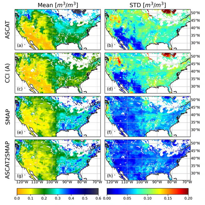
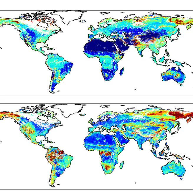
ASCAT2SMAP: image-to-image translation to obtain L-band-like soil moisture from C-band satellite data
2024
Performance of Drought Indices in Assessing Rice Yield in North Korea and South Korea under the Different Agricultural Systems
2022
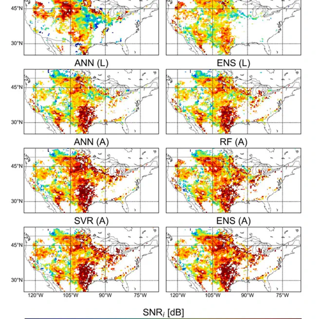
Improved soil moisture estimation: Synergistic use of satellite observations and land surface models over CONUS based on machine learning
2022
Satellite-based Drought Forecasting: Research Trends, Challenges, and Future Directions
2021
Estimation of Leaf Area Index Based on Machine Learning/PROSAIL Using Optical Satellite Imagery
2021
Detection of Forest Fire Damage from Sentinel-1 SAR Data through the Synergistic Use of Principal Component Analysis and K-means Clustering
2021
Wildfire Severity Mapping Using Sentinel Satellite Data Based on Machine Learning Approaches
2020
Improvement of spatial interpolation accuracy of daily maximum air temperature in urban areas using a stacking ensemble technique
2020
Development of Satellite-based Drought Indices for Assessing Wildfire Risk
2019